Contents
Are boundary lines on an aerial photo accurate, and how should you label them?
By the Duskpix team · Published 29 October 2026
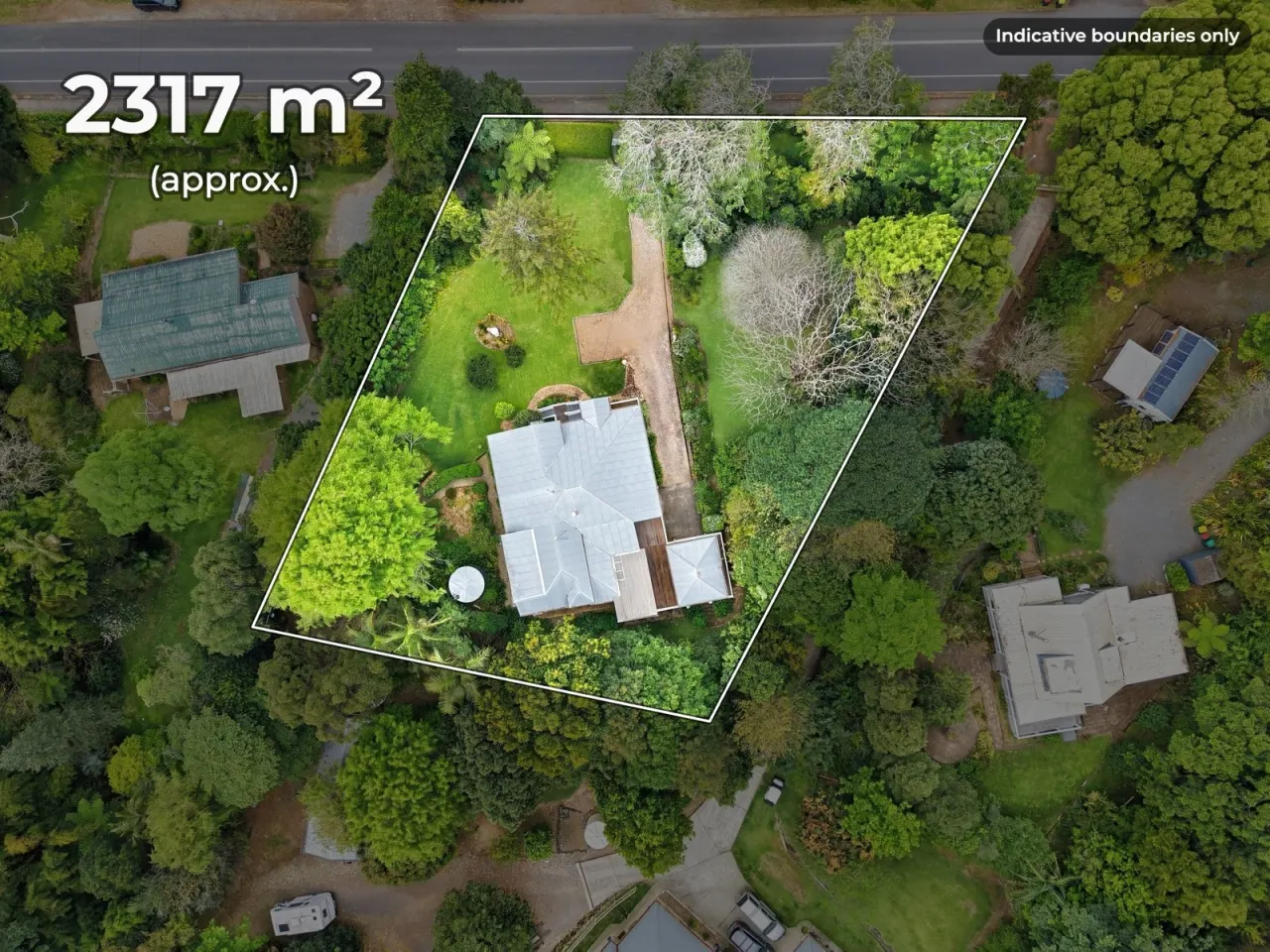
A boundary drawn on a drone photo is an illustration of roughly where the block is. It is never a survey, and the mapping agencies that publish the boundary data it is traced from say so about their own data. Buyers find it useful, regulators have not objected to it, and it becomes a problem only when it claims more than it knows. The fix is a label that says what it is, a land size taken from the title rather than the picture, and a line that does not wander onto the neighbour’s side.
The short answer
Keep using overlays. Label every one “Indicative boundaries only” or words to that effect, on the image itself. Quote the land size from the title or plan, marked approximate. Never let the line take in land that is not on the title, and never use the overlay to settle a question a buyer has about where the fence should be. That question is answered by a registered surveyor and nobody else.
Why an overlay is never a survey
Three things stand between the line on the photo and the boundary on the ground.
- The source data is approximate. Overlays are traced from a state’s digital cadastre or from the plan. Queensland’s own mapping help says the boundaries it shows “vary in positional accuracy”, that the state’s cadastral fabric “is a graphical representation only and is not the source of legal boundaries”, and that the true location of a boundary “is not determined using coordinates or imagery and can only be determined by a Registered Cadastral Surveyor” (Queensland Globe). Tasmania’s LISTmap describes its cadastral layer as indicative only (LISTmap). The other states publish similar caveats on their data.
- The photo is not a map. A drone shot is taken at an angle, with a lens, over ground that is rarely flat. Lines that are straight on the plan curve and foreshorten on the photo, and the person drawing them is matching fences and kerbs by eye.
- Fences are not boundaries. The fence the line is snapped to may itself be off the boundary by a metre, which is the usual reason boundaries end up in dispute at all.
None of this makes the overlay wrong to use. It makes it an indication, and the label should say so.
What the law says about land claims
The Australian Consumer Law bans misleading or deceptive conduct generally, and it has a specific provision for land: nobody may make a false or misleading representation about the nature of the interest in the land, the price, the location, the characteristics, the permitted use, or the facilities that come with it (NSW Fair Trading, quoting section 30). The size and shape of a block are characteristics of the land. The penalties for that section are set out in our virtual staging guide. Victoria puts size first among the characteristics of a property that must not be misrepresented (Consumer Affairs Victoria), treats the total size of the land in square metres as a key feature in the Property Price Statement that replaced the Statement of Information, and says it is illegal to misrepresent a property in any way when advertising it (Consumer Affairs Victoria).
No Australian regulator or tribunal has published a decision about a boundary overlay, as far as we can find. The nearest case is across the Tasman: in 2026 New Zealand’s Real Estate Agents Disciplinary Tribunal fined a licensee NZ$35,000 for telling buyers that subdivision lots were larger than their titles showed, and did not accept that the figures had come from the landowner (NZ Herald). The law is different, but the lesson is the same one the Australian provisions carry: a land size you publish is your representation, whoever gave it to you.
How to label the overlay
- Put the words on the image. “Indicative boundaries only” in a corner travels with the photo to every portal and social post. A note in the listing text does not.
- Repeat it in the listing text next to the land size: “Boundary lines are indicative only. Land size is approximate and taken from the title.”
- Keep the plan or title search you drew from, so you can show the source if a buyer or regulator asks.
- If a buyer asks whether a shed or a tree is inside the boundary, the answer is “the overlay is indicative; a surveyor can tell you”, not a closer look at the photo.
A label does not cure a line that is plainly wrong. If the overlay takes in the neighbour’s driveway, “indicative” does not save it, in the same way a “digitally altered” stamp does not save a photo with an added window (see our editing rules guide).
Where the land size should come from
From the title or the registered plan, not from the overlay and not from a mapping website. Print it as approximate: “2,317 m² (approx.)”. Where the title gives an area in an older unit or the block is irregular, say which document the figure comes from. If a vendor supplies a figure that does not match the title, use the title.
What not to do
- Do not draw the line to include a strip the neighbour uses, a road reserve or a battle-axe handle that is not on the title, even if the fence suggests it.
- Do not present an overlay as confirmation that a structure is inside the boundary.
- Do not dim or darken the neighbouring properties so heavily that the block reads as larger or more isolated than it is. A light dim that keeps the surroundings visible is fine.
- Do not derive a land size by measuring the overlay.
- Do not leave the label off because the photo “looks about right”.
This article is general information, not legal advice. For a specific listing, check with your agency’s compliance team, and for a specific boundary, a registered surveyor.
Boundaries in Duskpix
Duskpix’s boundary tool draws the line where you put it, dims the surroundings lightly, prints “Indicative boundaries only” on the photo by default, and adds the land size you type, with the approximate marker (see boundary lines). It also hands you the disclaimer sentence to paste into the listing. It is drawn on the photo, not generated, so nothing in the image changes except the lines and the label. Where the line goes is your judgement, from the plan.
Show the block. Label the line.
Boundary lines are free on every photo. Start with 50 free edits, with no card required.
Claim your 50 free edits